Siangyang National Forest Recreation Area
Taiwan · 臺東縣 · 海端鄉 · Nature & Scenery
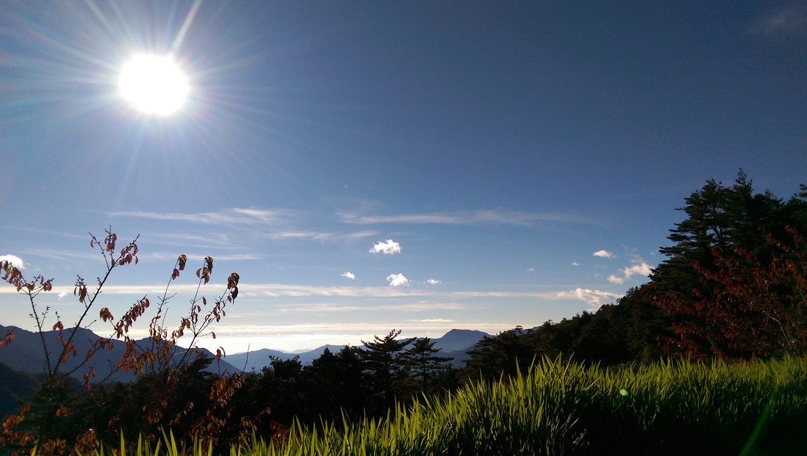
Image source: Taiwan_Opendata; license credits as shown.
Overview
Strolling along the winding forest roads through neatly planted red pine and Taiwan red cypress stands, visitors often meet fellow hikers carrying large backpacks; as they greet one another, a Mikado pheasant may quietly cross the road behind them and disappear into the grass, while fire-capped tits in the treetops keep chirping without pause. This is a scene people commonly encounter when visiting Siangyang National Forest Recreation Area. Compared with the well-known Jiaming Lake, the relatively small Siangyang National Forest Recreation Area, located at kilometer 154 of the Southern Cross-Island Highway and an elevation of 2,320 meters, is much more low-key. It features beautiful artificial forests and gentle trail networks. On the trails, visitors can easily hear the songs of a dozen or so mountain birds, and may see the national treasure Mikado pheasant as well as muntjacs and mountain goats strolling about. It is an ideal place for a relaxing half-day visit to enjoy cool high-elevation air, the neat beauty of planted forests, and rich ecology. Note: Siangyang National Forest Recreation Area is currently closed; the reopening date will be announced separately.
Getting There
[By car] Route 1: Southern Cross-Island Highway: Tainan → Jiaxian → Taoyuan → Meishankou → Tianchi → Yakou → Siangyang. (As post-disaster restoration work is underway on the Southern Cross-Island Highway, please contact the Jiaxian Public Works Section at 07-6751014 for traffic restrictions on the Tianchi → Yakou → Siangyang section.) [By car] Route 2: Southern Cross-Island Highway: Taitung → Guanshan → Lidao → Siangyang. (For traffic restrictions on the Southern Cross-Island Highway, please contact the Guanshan Public Works Section at (089)811024.) [By car] Route 3: Kaohsiung → Qishan → Jiaxian → Baolai → Taoyuan → Meishankou → Tianchi → Siangyang. (As post-disaster restoration work is underway on the Southern Cross-Island Highway, please contact the Jiaxian Public Works Section at 07-6751014 for traffic restrictions on the Tianchi → Yakou → Siangyang section.)
Highlights
• A high-mountain forest recreation area located around kilometer 154 of the Southern Cross-Island Highway at an elevation of about 2,320 meters, within a mid- to high-elevation mist forest zone. It is often shrouded in cloud and fog, with cool temperatures, making it a good place to escape the summer heat and experience mountain chill in winter. • Famous for its neat and beautiful planted stands of red pine and Taiwan red cypress, with gentle, easy trails suitable for a relaxing half-day walk and for appreciating the geometric beauty of artificial forests and high-mountain woodland scenery.[Official description] • Rich in ecological resources, it is a popular place for observing mountain birds and highland wildlife. Mountain birds are often heard singing, and at dawn, lucky visitors may encounter the national treasure Mikado pheasant, Swinhoe's pheasant, muntjacs, and mountain goats.[Official description] • An important gateway and trailhead for the Jiaming Lake National Trail, with trails such as Songjing and Songtao connecting to the Jiaming Lake National Trail. It attracts many hikers carrying large backpacks and serves as a base for both hiking and sightseeing. • It is currently closed, with only some trails used as access points to the Jiaming Lake National Trail. Travelers should check the latest official announcements and road safety information before planning a visit.
What to See
• Red pine and Taiwan red cypress plantation forest road Tall, straight red pines and Taiwan red cypresses are neatly arranged along the hillside. Walking through the area reveals the orderly, bright character of planted forests, while the winding road creates layered views that are excellent for photography.[Official description] • Mountain bird and highland wildlife observation More than ten kinds of mountain birds can be heard in the park, including fire-capped tits, and highland bird activity is frequent. In the early morning or when few people are around, visitors may encounter Mikado pheasants, Swinhoe's pheasants, muntjacs, and mountain goats moving through the trails, making this a favorite spot for ecological photography.[Official description] • Siangyang Trail and Siangsong Trail These trails have relatively gentle slopes. Along the way, the forest is mainly composed of red pine, Taiwan red cypress, and broadleaf trees with seasonal color changes. In autumn and winter, visitors can enjoy red leaves and falling foliage, making it suitable for short forest walks and for experiencing the fresh scents of high-mountain woodland. • Songjing Trail and Songtao Trail As part of the connecting route to the Jiaming Lake National Trail, these trails offer views of valleys and seas of clouds. In spring, roughly from March to May, orchid blooms line the trails and fill the air with fragrance, making this an excellent stretch for flower viewing and scenic overlooks. • Southern Cross-Island Highway mountain scenery Siangyang sits at a high point on the Southern Cross-Island Highway, with distant views of the Central Mountain Range ridgelines and the Xinueilv River basin. Sea-of-cloud and mist patterns change constantly, and when the weather is stable, the expansive views make this an important scenic stop for self-driving travelers on the Southern Cross-Island Highway.
Address
No. 7, Siangyang, Lidao Village, Haiduan Township, Taitung County 957 Phone: (089)324121, 0912103375, 0912103376
Travel Tips
• Current opening and closure status Siangyang National Forest Recreation Area is currently closed due to construction and safety considerations. It is only used as an access point connected with the Jiaming Lake National Trail and does not provide standard recreation-area facilities. The accessible areas and walking range are subject to on-site conditions and official announcements. Before departure, be sure to check the latest information on Taiwan's mountain recreation website or the websites of the Forestry and Nature Conservation Agency and the Taitung Branch Office. • Trail use and registration During the closure period, general visitors who only wish to take a short walk on the park trails usually must register personal information on-site before entering, and access may be limited to specific sections of the Jiaming Lake National Trail. Admission is free, and visitors must assume their own risk. The actual system and hours are subject to on-site announcements. • Mountain-entry permits and Jiaming Lake itineraries If you plan to reach Jiaming Lake or deeper mountain areas via Siangyang, you must apply for a mountain-entry permit in advance and also apply through the official Jiaming Lake National Trail system for a mountain hut or campsite. Only with approved documents may you enter the park for traverse or overnight trips. Please follow the latest regulations from the relevant authorities. • Best seasons and weather In general, late spring to early summer (around April to June) and autumn (around September to November) offer more stable weather and comfortable temperatures, with good conditions for sea-of-cloud and mountain views, as well as seasonal flowers and maple colors. Summer afternoons often bring thunderstorms and fog, while winter may bring low temperatures, frost, or even snow. Trails can be slippery and may be closed, so extra attention to equipment and driving safety is necessary. • Recommended gear The park is located at about 2,320 meters above sea level, where the day-night temperature difference is large throughout the year. A warm jacket, windproof and waterproof outer layer, and non-slip hiking shoes are recommended. Because afternoons are often cloudy, foggy, or showery, it is also advisable to bring rain gear, a cold-weather hat and gloves, a headlamp, and basic medical supplies, along with enough water and trail snacks in case supplies inside the park are limited. • Transportation and driving safety Siangyang is near the Kaohsiung–Taitung border on the Southern Cross-Island Highway, and the uphill drive from Guanshan in Taitung takes about 1.5 hours. Mountain roads are winding, and some sections may be affected by heavy rain or landslides. Before departure, check the latest road conditions and traffic control times for the Southern Cross-Island Highway, and allow enough time for the return trip to avoid the risks of thick afternoon fog or driving after dark in the mountains. • Current service facilities During the closure period, the park generally does not provide parking lots, dining services, trash bins, or visitor insurance. In some periods, only parking space and public toilets are available outside the park. Please take your trash with you. The visitor center may be under renovation or temporarily closed, so it is recommended to check in advance or contact the management unit by phone. • Safety and environmental protection Mountain weather changes quickly, so please pay attention to weather reports and typhoon or heavy-rain alerts at all times. Do not enter closed work areas or restricted road sections. When engaging in forest activities, follow Leave No Trace principles, do not feed wild animals, and do not leave litter, in order to protect Siangyang's precious ecological environment.
FAQ
Q: Is Siangyang National Forest Recreation Area currently open to general visitors? A: The official announcement currently states that it is "closed." Due to construction planning and safety concerns, the area is not open for normal recreation use and serves only as an access point for hiking routes such as the Jiaming Lake National Trail. The walkable trails and open areas must follow the latest announcements from Taiwan's mountain recreation website and the Forestry and Nature Conservation Agency and Taitung Branch Office. Q: If I only want to walk the forest trails at Siangyang for a half-day trip, how can I arrange it? A: During the closure period, visitors who want a relaxed walk in the park usually need to register on-site before entering, and access is generally limited to specific sections at the beginning of the Jiaming Lake National Trail. The trails are relatively gentle, and visitors can enjoy planted red pine and Taiwan red cypress forests as well as mountain bird ecology, making it suitable for a half-day high-mountain forest walk. The actual access range and rules are subject to on-site and official announcements. Q: Do I need to apply for a mountain-entry permit or authorization to visit Siangyang? A: If you only walk short distances within the trail areas allowed by the management authority, you usually do not need to apply for a mountain-entry permit in advance, but you still must comply with on-site registration rules. If you plan to enter the Jiaming Lake National Trail or deeper mountain areas via Siangyang, you must apply for a mountain-entry permit in advance and obtain hut or campsite permission through the official Jiaming Lake National Trail system, while following the relevant schedules and group-size limits. Q: What weather and transportation risks should I watch for when going to Siangyang National Forest Recreation Area? A: Siangyang is about 2,320 meters above sea level and lies in a high-mountain mist forest zone, so cloud, brief showers, and large day-night temperature differences are common. In winter there may even be frost or snowfall, and trails and roads can become slippery. In addition, the geology along the Southern Cross-Island Highway is relatively fragile, and heavy rain or typhoons may cause rockfalls, landslides, or traffic restrictions. It is recommended to check the latest weather and road conditions before departure and leave enough time for the drive and return trip.